If you love being on the water, choosing between Royal Harbor and Aqualane Shores can feel like splitting hairs. Both offer coveted Naples waterfront living, yet the best fit for you depends on your boat, your dock needs, and how you plan to use your home. You want a place where getting to open water feels easy, docking is stress‑free, and rebuild plans are clear.
This guide gives you a simple, boater‑first framework to compare the two neighborhoods. You will learn what to measure on each property, how to estimate realistic travel times to the Gulf, and which permits and rules matter for docks, seawalls, and rebuilds. Let’s dive in.
How to compare for boaters
Start with your vessel profile
Begin with the basics of your current or planned boat. Write down your length overall (LOA), beam, draft at mean low water (MLW), and air draft. Also note propulsion type, as twin inboards or pods turn differently than outboards. These specs will drive dock fit, turning room, and canal depth needs in both Royal Harbor and Aqualane Shores.
Map your route to open water
Sketch your path from a typical dock in each neighborhood to Naples Bay, then out to the Gulf, often via the Naples Bay channel and Gordon Pass. Count the turns, likely no‑wake stretches, and any spots that might shoal. This is a practical way to compare convenience beyond simple distance.
Know what to measure on site
On a property‑by‑property basis, verify canal width, depth at MLW at the dock, and the distance to a usable turning basin. These three factors set the ceiling for vessel size and stress level when docking. Conditions can change after storms, so always note the date of measurement.
Navigation and access factors that matter
Canal width and passing room
Canal width affects safe passing and how comfortably you can pivot or back into a slip. Wider canals make larger beams and twin‑engine maneuvers simpler. Measure the clear water width in front of the lot and at any narrow points you must transit. Confirm with recent aerials or an on‑site measurement.
Depth at mean low water
Depth at MLW determines your draft limit. Private canals can silt, and dredging schedules vary. Ask for recent depth measurements at the dock and along the canal route. Verify the date and whether readings are tied to MLW. If you run a deeper‑draft vessel, put depth at the top of your checklist.
Turning basins and end conditions
Larger vessels need room to turn. Many harbor design guides suggest a turning circle of about 1.5 to 2 times your boat’s LOA for comfortable maneuvering, though propulsion, wind, and current can change what you need. Identify the nearest turning basin and estimate its diameter, or confirm with a surveyor.
Fixed bridges and overhead limits
Air draft matters for tall flybridges, towers, and masts. Confirm the presence or absence of any fixed bridges or low overhead structures on your route from dock to bay. Note low wires or tree limbs near docks as well. Record clearances and compare them to your boat’s air draft with margin.
Obstructions, shoaling, and maintenance
Ask about recent dredging, known shoaling, and any obstructions in the canal or on the route to Naples Bay. Local marinas and harbormaster contacts can provide practical insight. Depths can change seasonally, so seek dated records and plan to recheck before closing.
Travel time: realistic ranges and method
Getting to the Gulf is about both distance and speed controls. Expect lower speeds in neighborhood canals and no‑wake zones within Naples Bay. Wind and current can add time when docking. Here is a simple method you can use before you fly down for tours:
- Identify a typical dock location in Royal Harbor and in Aqualane Shores.
- Trace the safe route to Naples Bay, then out to the Gulf via the marked channels.
- Measure the distance in nautical miles along that route.
- Calculate a time range. Inside canals and in parts of the bay, plan around 10–15 knots or local no‑wake speeds. In open, safe stretches, 15–30 knots may be reasonable, depending on conditions and vessel type.
- Add time for line handling, leaving and approaching the dock, and tide or current.
You will likely find that practical time differences come down to your exact canal position, the number of tight turns, and how much of your route is speed‑restricted.
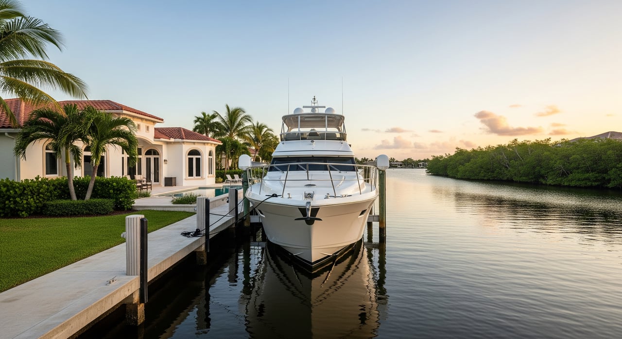
Dock, lot, and home profiles to evaluate
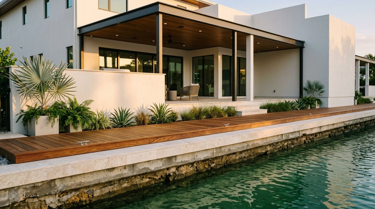
Waterfront width and slip length
Lot waterfront width at the bulkhead influences slip options and lift size. Ask for the recorded lot width and a measured slip length at the existing dock. If you plan to change the dock, confirm what is permitted for that parcel and canal.
Dock types and lifts
Common dock builds include fixed wood or concrete docks and lifts sized to typical local boats. Floating elements can help with tidal variation. Verify the current dock’s condition, lift capacity, and whether there is space and permit potential for a larger lift if needed.
Seawalls and maintenance
Seawalls are a core asset for any canal property. Ask when the seawall was last replaced or repaired, the material used, and whether it meets current standards. Older seawalls can affect both safety and insurance. Replacement is a significant cost to plan for in your budget.
Privacy and canal traffic
Canal living places you close to the water and your neighbors’ docks. Look at side‑yard setbacks, typical dock spacing, and whether your canal gets significant through‑traffic to the bay. Vegetation and fencing can help with privacy, subject to local rules.
Rebuild, permits, and insurance: what to know
Flood zones and finished‑floor elevations
Most waterfront parcels will have flood zone requirements. If you plan to rebuild or substantially renovate, your project must meet the Florida Building Code and local finished‑floor elevation rules tied to FEMA flood maps. Elevation requirements can affect design, cost, and timeline.
Dock and seawall permitting
Docks, lifts, and seawalls typically require permits. Review any past permits for the property and ask what is allowed today for dock length, lift size, and seawall replacement. If private dredging is common on that canal, ask about schedules and responsibilities.
Insurance and financing implications
Flood zone, elevation, seawall age, and roof and window systems can influence insurance premiums and lender terms. Before you finalize an offer, consult with a local marine‑savvy insurance agent and your lender to stress‑test your budget.
Royal Harbor vs Aqualane Shores: boater checklist
Use this quick comparison to organize your due diligence. Because canals and lots vary, treat each cell as a verification prompt for that specific property.
| Criteria | Royal Harbor | Aqualane Shores |
|---|---|---|
| Canal width at lot | Measure clear water width at the property and narrowest transit points; confirm with recent imagery and on‑site checks. | Same verification; note any pinch points along your route to Naples Bay. |
| Depth at MLW | Record depth at the dock and along the canal; ask for dated measurements and any recent dredging. | Same; confirm any shoaling history and the most recent dredge records. |
| Turning basin access | Identify the nearest turning basin and estimate diameter; test with your LOA. | Same; confirm end conditions where canals terminate. |
| Overhead clearance | Verify presence or absence of bridges or low structures; compare to your air draft. | Same; note wires or trees near docks. |
| Route complexity | Map the number of turns and no‑wake stretches to Naples Bay and out to the Gulf. | Do the same; compare routes side by side for simplicity. |
| Dock and lift | Measure current slip length and lift capacity; review permits for expansion. | Same; confirm space for a larger lift if needed. |
| Seawall condition | Ask install date, material, and most recent repair; budget for replacement if older. | Same; request permits and contractor records. |
| Privacy and traffic | Observe dock spacing and canal traffic patterns during peak times. | Same; note proximity to marinas or public access that increase boat traffic. |
| Rebuild feasibility | Check flood zone, required finished‑floor elevation, setbacks, and lot coverage. | Same; verify any neighborhood‑specific standards. |
Smart steps to verify before you write an offer
- Confirm owned slip length at the property, plus lift specs and available expansion options.
- Measure canal width at the lot and the narrowest point you must pass to reach Naples Bay.
- Verify depth at MLW at the dock and along the canal, with measurement dates.
- Locate the nearest turning basin and estimate its diameter against your LOA.
- Map the route to the Gulf and estimate a time range with realistic speeds and no‑wake segments.
- Review permits for the dock, lift, and seawall, plus any dredging records.
- Check FEMA flood zone and finished‑floor elevation requirements for rebuild plans.
- Discuss insurance implications tied to elevation, seawall age, and roof and window systems.
Which neighborhood is best for you?
Both Royal Harbor and Aqualane Shores can deliver a great boating lifestyle. The better choice depends on your vessel specs, your appetite for tight maneuvering, and how quickly you want to reach open water from your specific canal. A well‑matched lot with the right depth, width, and turning room usually matters more than the neighborhood label.
If you want a tailored, on‑the‑water plan, we can help you measure the essentials, compare routes, and coordinate the right marine and permitting experts so you can buy with confidence. For a private consultation and a property shortlist aligned to your boat and goals, connect with Tom & Sue Weidlich.
FAQs
Which Naples neighborhood gets me to the Gulf fastest?
- It depends on your exact canal location, no‑wake stretches, and turns to Naples Bay and Gordon Pass; map a route for each property and time it using realistic speeds.
Can I keep a 60–80 ft yacht at a private dock?
- Possibly, but confirm canal width at the lot, depth at MLW, nearest turning‑basin diameter, and actual slip length and lift capacity; verify all with dated measurements.
Are there dredging or shoaling issues I should know about?
- Conditions can vary by canal and season; request recent dredging records, ask about known shoaling, and confirm current depths with a marine surveyor before closing.
What rules apply if I plan to tear down and rebuild?
- Expect to meet Florida Building Code and local requirements, including FEMA‑driven finished‑floor elevations, plus zoning setbacks and lot coverage; permits are required.
What if my boat has a tall tower or mast?
- Check for any fixed bridges or overhead obstructions on your route, record true clearances, and compare to your air draft with margin; confirm again at high tide.